
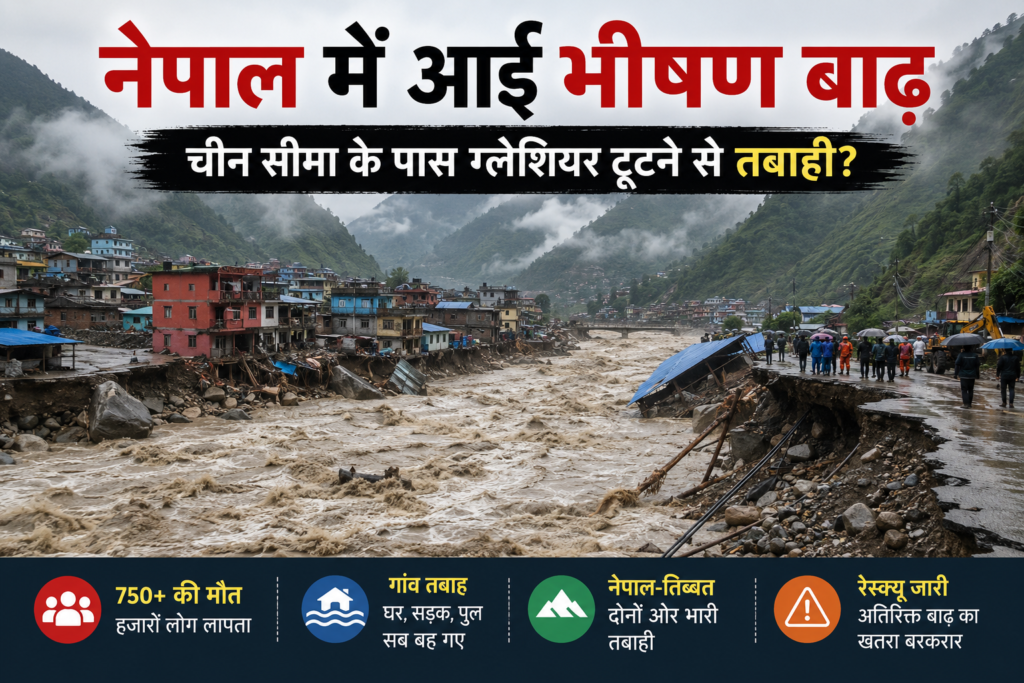
On the morning of August 26, 2026, people living in parts of Nepal and the neighbouring Tibetan region of China witnessed a disaster that developed with frightening speed.
A massive volume of ice, rock, mud and debris came crashing down from the high Himalayan mountains near the Nepal–China border. Within a short period, normally flowing mountain rivers turned into violent torrents capable of carrying enormous boulders, trees, vehicles and parts of buildings downstream.
Villages were devastated. Roads disappeared. Bridges were washed away. Hydropower infrastructure was damaged, and thousands of residents, workers, tourists and pilgrims suddenly found themselves caught in one of the region’s worst recent natural disasters.
According to Reuters, by August 30 the combined death toll in Nepal and Tibet had reached around 750 people, while more than 3,000 people were reported missing. Rescue operations were continuing, meaning these numbers were not necessarily final.
But as disturbing videos of the flood started circulating online, another claim quickly began spreading:
Did a giant iceberg break somewhere in China and cause the Nepal flood?
The scientific explanation is more complicated.
According to preliminary assessments by the International Centre for Integrated Mountain Development (ICIMOD) and reports based on satellite observations, the disaster appears to have started with a huge ice-and-rock avalanche or glacier/bedrock collapse in the Himalayan region near the Nepal–China border.
Importantly, currently available evidence suggests that the initial collapse originated on the Nepalese side of the international border, rather than an iceberg simply travelling from China into Nepal.
So what actually happened?
Let’s understand the disaster step by step.
What Happened in Nepal on August 26, 2026?
The disaster began high in the mountains close to Nepal’s border with the Tibet Autonomous Region of China.
According to ICIMOD’s preliminary assessment, a large volume of ice and rock entered the Lhende Khola and generated an extremely powerful downstream surge.
This was much more dangerous than an ordinary increase in river water.
Imagine an enormous section of mountain containing fractured rock, glacier ice and loose material suddenly breaking away and accelerating down a steep Himalayan slope.
As the material travelled downhill, it mixed with additional sediment, rocks and water.
The result was a fast-moving mass of debris capable of destroying almost everything standing in its path.
The Lhende Khola, which connects with the Bhote Koshi and ultimately the Trishuli river system, became one of the pathways through which the effects travelled downstream.
According to information published by ICIMOD, extraordinary changes in river levels were recorded.
At Galchhi, the Trishuli River reportedly rose by approximately nine metres within around 30 minutes, while Malekhu recorded a rise of roughly seven metres over a similar period.
For people living beside these rivers, this meant conditions could change from apparently normal to catastrophic within minutes.
There was very little time to escape.
Source: International Centre for Integrated Mountain Development (ICIMOD), preliminary assessment published August 26, 2026.
Did an “Iceberg From China” Really Cause the Nepal Flood?
This is one of the biggest questions surrounding the disaster.
Several social-media posts have described the event as a huge “iceberg” breaking in China and travelling towards Nepal.
Scientifically, however, iceberg is not the correct term for what appears to have happened.
An iceberg is normally a large piece of ice that has separated from a glacier or ice shelf and is floating in water, particularly in an ocean or large lake.
The Nepal disaster appears to have involved something very different.
Preliminary scientific evidence points towards a massive glacier, ice-and-rock or bedrock collapse, producing an avalanche that travelled rapidly downhill.
Satellite analysis reported by The Kathmandu Post, citing experts studying the event, indicated that the collapse involved not only ice but also underlying bedrock.
That distinction is extremely important.
A large mountain slope collapsing together with glacial ice contains an extraordinary amount of gravitational energy.
As it travels downhill, it can pick up:
- rocks,
- mud,
- sediment,
- additional ice,
- trees,
- water, and
- anything else in its path.
The resulting mass can temporarily block a river.
Water then accumulates behind this natural barrier.
If that temporary blockage suddenly fails, an enormous amount of stored water and debris can be released downstream.
Therefore, instead of saying:
“An iceberg broke in China and flooded Nepal,”
a more accurate explanation based on information currently available would be:
“A massive ice-and-rock/glacial collapse near the Nepal–China border triggered a cascading avalanche, debris flow and destructive flooding.”
Scientists are still investigating the precise sequence of events.
Where Did the Glacier Collapse Actually Happen?
The location has created considerable confusion because the disaster affected both Nepal and Tibet.
According to scientific assessments and satellite observations reported after the event, the initial ice-and-rock collapse appears to have occurred on the Nepalese side of the Nepal–China border.
However, its consequences crossed the international frontier.
This is why the event is better understood as a transboundary Himalayan disaster rather than simply a “Nepal flood” or “China flood.”
Natural disasters obviously don’t recognise political borders.
Glaciers, rivers and mountain ranges continue across national boundaries.
An avalanche beginning in one country can block a river that flows through another country.
Similarly, a flood created upstream can devastate settlements many kilometres downstream.
The August 26 disaster demonstrated exactly how vulnerable Himalayan border communities can be.
The Disaster Hit Nepal and Tibet
The devastation wasn’t limited to one country.
Nepal’s Rasuwa district was among the areas severely affected.
On the Chinese side, communities in Tibet’s Gyirong County were also hit.
The Gyirong border area is particularly important because it provides a major transport and trade connection between Nepal and China.
Floodwaters and debris damaged infrastructure throughout the region.
Roads disappeared under mud.
Bridges were swept away.
Buildings were damaged or completely destroyed.
Vehicles were caught in the flood.
Hydropower facilities and other infrastructure were also affected.
According to Associated Press reporting, the disaster affected local communities as well as travellers, workers and pilgrims moving through the Himalayan region.
This included foreign nationals travelling towards religious and tourist destinations.
750 Dead and More Than 3,000 Missing
The human cost has been enormous.
According to Reuters’ August 30, 2026 update, the combined reported death toll in Nepal and Tibet had reached approximately 750.
More than 3,000 people were still reported missing.
In Nepal alone, authorities reported hundreds of deaths and thousands of missing people.
Chinese authorities also reported deaths and missing people in Tibet.
More than 90,000 people were estimated to have been affected by the disaster.
These numbers, however, should be treated as provisional.
In major disasters, official casualty numbers frequently change.
Some villages may initially be inaccessible.
People listed as missing may later be found alive.
Other victims may only be discovered when rescuers reach previously inaccessible areas.
This is why responsible reporting should always mention when casualty figures were reported rather than presenting them as permanent final numbers.
Source: Reuters, August 30, 2026.
Why Was This Flood So Destructive?
Several natural processes appear to have combined to create the catastrophe.
Massive Ice-and-Rock Collapse
The initial collapse appears to have involved an enormous quantity of material.
When millions of tonnes of rock and ice move rapidly down a steep mountain, they release tremendous energy.
Debris Mixed With Water
This was not simply clean floodwater.
The moving material contained mud, rocks, sediment, ice and other debris.
A debris-filled flood is much heavier and more destructive than ordinary water.
A bridge capable of surviving normal seasonal flooding may not survive repeated impacts from massive boulders travelling downstream.
Narrow Himalayan Valleys
Himalayan rivers often run through steep and narrow valleys.
These valleys can concentrate the energy of a flood.
Instead of water spreading harmlessly over a large open area, it is forced through confined channels containing villages, roads, bridges and infrastructure.
Temporary River Blockages
Large avalanches and landslides can also create temporary natural dams.
Water accumulates behind them.
When these unstable barriers collapse, the stored water can suddenly rush downstream.
Extremely Little Warning Time
Perhaps the most frightening part of the disaster was its speed.
ICIMOD’s river-level observations indicated dramatic increases within approximately half an hour at some downstream monitoring locations.
When a river rises several metres in such a short period, conventional evacuation becomes extremely difficult.
Why Are Rescue Operations So Difficult?
The Himalayan landscape that attracts tourists from around the world also makes disaster rescue extremely challenging.
Many affected communities are connected by only one or two mountain roads.
If a landslide destroys those roads or a flood washes away a bridge, an entire community can suddenly become inaccessible by land.
Helicopters provide another option, but flying in the Himalayas is difficult.
Heavy clouds, rain, strong winds and poor visibility can prevent helicopters from reaching affected communities.
Additional landslides are another major danger.
Rescue teams therefore aren’t simply searching through the remains of one disaster.
They may be operating in an environment where another landslide or flood can occur.
Reports also indicated concerns about people trapped around tunnels and hydropower infrastructure.
This requires specialised rescue teams and equipment.
Nepal therefore sought outside assistance in areas including specialised rescue operations and identification of victims.
Is Climate Change Responsible for the Nepal Flood?
This question needs to be handled carefully.
It is tempting to look at a glacier-related disaster and immediately say:
“Climate change caused it.”
But individual geological disasters are more complicated.
Scientists need to study the glacier, geology, temperatures, precipitation, slope structure and several other variables before attributing a particular event directly to climate change.
Therefore, it would currently be inaccurate to say climate change has been scientifically proven to be the sole cause of the August 26 collapse.
However, there is a much broader concern.
The Himalayan cryosphere is changing.
Glaciers across the region are retreating as temperatures rise.
Frozen ground and mountain slopes can also become less stable as ice disappears.
The International Centre for Integrated Mountain Development has repeatedly warned about rapid changes affecting glaciers, snow and frozen environments across the Hindu Kush Himalaya.
Frozen water isn’t only sitting on the surface of glaciers.
Ice can also exist inside cracks and fractured rock.
In some environments, this frozen material helps stabilise mountain slopes.
When temperatures increase, that ice can melt.
Water can penetrate cracks.
Previously frozen rock can become less stable.
This doesn’t mean every landslide is caused by global warming.
But it does mean climate change can alter the environmental conditions in which mountain hazards develop.
That is why scientists are concerned.
The Himalayas Are Changing Faster Than Many People Realise
The Hindu Kush Himalayan region is sometimes referred to as part of the world’s “Third Pole” because of the enormous quantity of frozen water stored in its glaciers and snowfields.
These glaciers feed some of Asia’s most important rivers.
Hundreds of millions of people ultimately depend on water originating in these mountains.
But glaciers are shrinking.
This creates several different problems.
During some periods, accelerated melting can increase water entering rivers and glacial lakes.
Retreating glaciers can also leave behind unstable rock, sediment and expanding lakes.
Over longer periods, continued glacier loss could reduce the reliability of glacier-fed water supplies.
There is therefore a strange and dangerous contradiction:
Some Himalayan communities could face increased flood and landslide hazards while simultaneously facing long-term concerns about water availability.
What Is a Glacial Lake Outburst Flood?
You may have seen the term GLOF mentioned in reports about Himalayan disasters.
GLOF stands for Glacial Lake Outburst Flood.
As glaciers retreat, meltwater can accumulate and form lakes.
Unlike conventional reservoirs, some glacial lakes are held back by loose sediment, rocks and ice.
If the natural barrier fails, a huge volume of water can suddenly escape.
That produces a Glacial Lake Outburst Flood.
However, not every glacier-related disaster should automatically be called a GLOF.
In the August 2026 Nepal disaster, current evidence suggests a more complicated chain beginning with a major ice-and-rock or bedrock collapse.
The avalanche then interacted with the river system, creating destructive downstream effects.
Researchers therefore need satellite imagery, seismic data, river measurements and field evidence to reconstruct exactly what happened.
Why Early-Warning Systems Could Save Thousands of Lives
One of the clearest lessons from this tragedy is:
Every minute counts.
An unstable glacier or mountain slope may be located kilometres away from the nearest settlement.
People living downstream may have no idea that something catastrophic has happened upstream.
By the time they hear the flood approaching, escape may be impossible.
Modern Himalayan warning systems therefore need multiple technologies working together.
Satellite monitoring can help identify unstable glaciers and mountain slopes.
Seismic instruments may detect enormous avalanches and landslides.
River gauges can identify sudden increases in water levels.
Remote cameras can monitor dangerous valleys.
But detecting a disaster isn’t enough.
The warning must reach ordinary people.
Mobile alerts, emergency sirens, radio networks and local disaster-management teams need to communicate immediately.
Villages also need clearly identified evacuation routes leading towards higher ground.
Nepal and China Need Better Cross-Border Warning Systems
The August disaster also demonstrates why Nepal and China need strong cooperation over Himalayan hazards.
Suppose an avalanche occurs close to an international border.
Within minutes, it may enter a river.
The river may then flow into another country.
In that situation, information held by one government can be extremely important to communities living in the other.
Countries therefore need rapid mechanisms for sharing information about:
- river levels,
- glacier movement,
- landslides,
- rainfall,
- temporary river blockages,
- seismic events,
- satellite observations, and
- emerging flood threats.
This isn’t simply diplomatic cooperation.
For communities living downstream, receiving information ten minutes earlier could mean the difference between escaping and being trapped.
What Does the Nepal Disaster Mean for India?
India wasn’t the centre of this disaster, but the lessons are extremely relevant.
India shares the Himalayan mountain system with Nepal, China and Bhutan.
States including Uttarakhand, Himachal Pradesh, Sikkim and Arunachal Pradesh contain glaciers, steep mountain valleys, hydropower projects and settlements located close to rivers.
India has already experienced similar warnings from the Himalayas.
The 2013 Kedarnath disaster demonstrated how extreme rainfall and mountain flooding can devastate entire communities.
The 2021 Chamoli disaster in Uttarakhand provided another frightening example of how a rock-and-ice avalanche can produce destructive downstream flows.
The Nepal disaster therefore reinforces an important lesson for India:
Monitoring rainfall alone isn’t enough.
Scientists and authorities also need to monitor what is happening thousands of metres above the river — on glaciers, mountain slopes, glacial lakes and unstable rock formations.
Hydropower Projects Are Particularly Vulnerable
Nepal has enormous hydroelectric potential.
Its steep terrain and fast-flowing rivers make hydropower attractive.
But those same conditions create serious hazards.
Powerhouses, access roads, worker accommodation, tunnels and transmission infrastructure are often built close to mountain rivers.
An extreme debris flow can therefore hit areas containing both expensive infrastructure and large numbers of workers.
Future Himalayan hydropower projects may need to evaluate risks beyond conventional flooding.
Engineers shouldn’t only ask:
“How high could this river rise during heavy rainfall?”
They may also need to ask:
“What happens if a glacier or part of a mountain collapses upstream?”
That requires a very different type of risk assessment.
Could Another Flood Happen?
Unfortunately, the danger doesn’t necessarily disappear after the first flood.
A major landslide can leave enormous quantities of unstable material behind.
Debris may create temporary river blockages.
Water can accumulate behind these barriers.
Heavy rainfall can destabilise additional slopes.
Previously deposited material can move again.
According to Associated Press reporting on August 30, authorities were still concerned about additional flooding as rainfall continued in affected areas.
That means survivors may face the frightening possibility of another emergency while rescue and recovery operations from the first disaster are still underway.
The Human Story Behind the Disaster
News coverage naturally focuses on numbers.
750 dead.
Thousands missing.
Thousands displaced or affected.
Roads destroyed.
Bridges gone.
But every number represents someone’s life.
Someone went to work that morning.
Someone was travelling.
Someone was operating a shop.
Someone was working inside a hydropower project.
Someone was travelling towards a religious pilgrimage.
Someone was having breakfast with their family.
Then, within minutes, everything changed.
That is what makes flash floods and mountain avalanches particularly terrifying.
Communities can understand normal monsoon flooding because they have experienced it for generations.
A giant ice-and-rock avalanche triggering a cascading debris flood is completely different.
Past experience may provide very little warning.
Could the Disaster Have Been Prevented?
Stopping a massive mountain from collapsing may be impossible.
But reducing the number of people killed by such disasters is possible.
Scientists can identify potentially unstable areas.
Satellites can monitor changes.
River sensors can detect sudden water-level increases.
Seismic instruments can detect massive landslides.
Automatic systems can send warnings downstream.
Governments can map evacuation routes.
Communities can practise emergency procedures.
Critical infrastructure can be designed with extreme geological events in mind.
Disaster management isn’t always about preventing nature from doing something.
Sometimes it means giving people enough information and enough time to get out of the way.
Conclusion: A Warning From the Himalayas
The Nepal–Tibet disaster of August 2026 shouldn’t simply be described as an “iceberg from China.”
Current scientific evidence points towards a far more complex and extraordinary event.
A massive collapse involving glacial ice, rock and possibly underlying bedrock occurred near the Nepal–China border, apparently originating on the Nepalese side.
The resulting avalanche entered the river system and helped generate an enormous cascade of debris and floodwater that devastated communities in both Nepal and Tibet.
Scientists are still investigating exactly why the mountain failed and the precise sequence through which the initial collapse produced such extensive downstream destruction.
Climate change shouldn’t be presented as the scientifically proven sole cause of this individual event.
However, the wider warning is difficult to ignore.
The Himalayas are changing.
Glaciers are retreating.
Frozen environments are warming.
Mountain slopes can become unstable.
Glacial lakes are changing.
And millions of people continue to live downstream from these rapidly evolving environments.
For Nepal, China, India, Bhutan and other countries connected to the Himalayan ecosystem, better glacier monitoring, satellite surveillance, early-warning systems and international data sharing are becoming increasingly important.
The mountains may look permanent.
But they are constantly changing.
And the tragedy of August 26, 2026 demonstrates just how quickly something happening high above an isolated Himalayan valley can become a disaster affecting thousands of people downstream.
Sources & References
Information in this report has been compiled using publicly available reporting and scientific assessments from:
International Centre for Integrated Mountain Development (ICIMOD) — Preliminary scientific assessment of the August 26, 2026 Rasuwa flash flood and the ice-and-rock avalanche near the Nepal–China border.
Reuters — August 30, 2026 reporting on casualties, missing people, rescue operations and continuing flood risks in Nepal and Tibet.
Associated Press (AP) — Reporting on rescue operations, affected communities and continuing flood risks in Nepal and Tibet.
The Kathmandu Post — Reporting and expert analysis concerning satellite observations, the Bhotekoshi flood and the suspected glacier/bedrock collapse.
Readers should consult these organisations and official Nepalese and Chinese authorities for subsequent updates because this remains a developing situation.
Disclaimer
Disclaimer: This article is published by KissaTV.com for news, informational and educational purposes. Information has been compiled from publicly available reports from established news organisations, scientific institutions and relevant authorities.
The Nepal–Tibet flood remains a developing event. Figures concerning deaths, missing people, injuries, affected populations and infrastructure damage may change as rescue and recovery operations continue.
Casualty figures quoted in this article reflect information available on August 30, 2026 and should not be considered final.
The precise scientific mechanism responsible for the initial mountain collapse and subsequent flooding remains under investigation. KissaTV does not independently claim that climate change, China or any other individual factor has been conclusively established as the sole cause of the disaster.
Some images or videos associated with the event may originate from news agencies, authorities or social-media sources. Their respective copyrights remain with their original owners. KissaTV does not claim ownership of third-party material unless explicitly stated.
Readers located in or travelling through affected areas should rely on instructions and safety alerts issued by local authorities rather than this article for emergency guidance.
Article information last updated: August 30, 2026.